
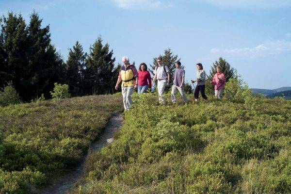
Ettelsberg & Willingen circular hike
Who the large regional hiking trails are too long or exhausting and prefer a more extensive Walking tour to get to know his holiday resort Willingen We have a personal recommendation for him. It is our own path of heart!
A beautiful 5-6km long tour around the Ettelsberg in Willingen, where you can explore nature, the place and many sights. This tour is also very suitable for families, as there are many things to see on the way and discover that children don't get bored. In various places, children can be shortened when they are tired.
The starting point is the Kurpark or the cable car valley station. The path leads to Ettelsberg, through Hochheide and Wald to Mühlenkopfschanze and from there through the Stryck and Stryckpark under the Viaduct into the local centre for strolling in the business street, at the end of which you will reach the spa park again.
Find out more about the route and description Here
Show more
Hochheide Rundwanderweg Ettelsberg - Neuer Hagen
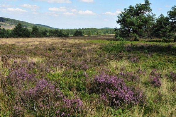
One of the most popular Sauerland walks leads from Willingen via Ettelsberg to Germany's largest New Hagen, Germany (Niedersfelder Hochheide) and the Langenberg (with 843m the highest mountain of the Sauerland) and through the Hoppecketal back to Willingen. It is a circular hiking trail.
The recommended route starts at the valley station of the Ettelsberg cable carBy train you go to the 838m high Ettelsberg with its High-Heath tower - the highest vantage point northwest Germany at 875m - and Siggi's famous Ettelsberg hut.
Then it goes past the Kyrill Path to the New Hagen, Germany, the highlight of the tour. From 838m high View point at Clemensberg you have a nice view over the Winterberg plateau. At the end of the Hochheide waits the Lower fields High-Heathed Hut, where you can strengthen yourself on about half of the way. Then you go to the Langenberg (with 843m the highest mountain in the Sauerland) and from there downhill to Hoppecketal and back to Willingen.
The tour is about 13km and takes about 3 hours of walking time. However, you should take a break, stopover, views and enjoyment for 6 hours. The route runs mostly on forest roads - but firm footwear is recommended.
Show more
Ettelsberg, Skywalk and Hochheide circular hike
A beautiful circular hike from the mountain station Ettelsberg over the Skywalk to the Hochheide Neuer Hagen and back. The theme hiking trail "The Golden Path" leads through the Hochheide (Info click HERE).
Information about the Skywalk can be found HERE.
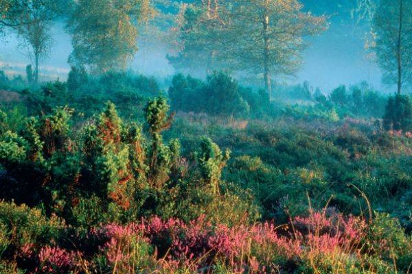
The Neue Hagen, also called Niedersfelder Hochheide, is a 73.89 ha nature reserve and FFH area in the Sauerland. The area extends as a Hesse-Westphalian border region between Clemensberg (837m) and Ettelsberg (838m). Maximum Hochheide in GermanyHere a unique high-heath landscape and a high-moor with very rare plant and animal world have developed.
The plateau Ettelsberg-Neuer Hagen is the most popular hiking region in the Sauerland amidst a completely traffic-free area of almost 100 square kilometers. Rothaarsteig and Uplandsteig lead through the area.
Route history on Google Maps click HERE
Show more

Milk experience trail Usseln
The Family Nature Experience - the milk adventure trail Usseln is a family hiking trail with 10 exciting active adventure stations around the milk. It is part of the Milk and milk products Upland dairy for organic milk.
The 6.4km long circular trail starts at the Tourist Information in Usseln. For children there is a Quizbow (download here), which is completed and handed out at the end of the path in the Upland dairy for children up to 14 years. The quiz sheet is also available alternatively in the tourist info Usseln.
The trail with 10 adventure stations leads along the young Diemel past the former ski jumping hill Usseln to the Ententeich with playground. At the Pön Hütte at the Usselner ski lift there is then the first participation station. Continue on to the Diemel spring with the Kuhglockenspiel and then up to the Graf Stollberg hut, where a Heustadl cinema is located. Then we take a panoramic path to the Hochheide Kahle-Pön, where you can pick blueberries in summer - and then go down again towards MilchMUHsuseum in Usseln. On the way you will find more adventure stations.
The milk adventure trail is suitable for cross-country prams and in combination with the MilkMUHseum it is a nice adventure trip for the family. Duration with children approx. 3.5 hours. On the way there are two stopovers at the Pön hut and Graf Stolberg hut. Distance on Google Maps HERE More info: www.milchpfad-usseln.deShow more

Uplandsteig - a hiking dream
The Uplandsteig, a challenging 64 km long hiking trail, leads once around and through the municipality of Willingen (Upland), with 1,487 metres of altitude. The description of the Uplandsteig was divided into 5 km sections on the hiking map.The face of the landscape changes again and again, from mixed forest, beech forest, field corridor, flowering meadows, swamp landscapes and high heaths. The hiker awaits numerous beautiful views from the highest peaks of the Sauerland.
At times, the Uplandsteig shares its path with the Rothaarsteig, the Sauerland Höhenflug, Diemelsteig and the Briloner Kammweg.
More information: Upland Steig

Upland Pilgrim's Way - Reflection Path "Tracks of Life"
"The way is the goal" If the world-famous "Jakobsweg" is too long and too far away or does not fit in with holiday planning, there is an interesting alternative in small format. "Uplander Pilgrim's Way One can reach inner contemplative peace and recharge your energy for spirit and soul on a weekend. Follow the footsteps of your life! The easily walkable circular trail of 17km length is divided into four sections with 46 meditation stations and offers not only wonderful hiking trails and impressive views – but also want to lead you in peace and reflection over your life. The Upland Pilgrim's Trail is a kind of "trimm-dich path" for the soul. For the well-marked route no hiking map is needed. On your pilgrimage you will be accompanied by station signs with contemplative topics and suggestions. Highlights on the pilgrimage route are the "Pilgrim Church" in Schwalefeld and the "Lichterkirche" in Rattlar. Upland reflection
Show more

Redhair Trail - the way of the senses
With its special proximity to nature, the gently curved lines, the clear waters and the wealth of views, the redhead's trail opened in 2001 and 154km long is now considered as a hiking friend. Germany Trail No. 1. No other hiking trail attracts more visitors. It leads from Brilon via Winterberg, Bad Berleburg to Dillenburg. Route: The Rothaarsteig leads north-south direction over the ridge of the Rothaargebirge beginning in Brilon. Then passes Langenberg/Hochheide and past the Ruhr spring to Winterberg to Kahlen Asten. From here we go west to the Rhine-Weser Tower, then southward through the redheads in the Hilchenbacher Winkel and into the spring area of Lahn, Sieg and Eder. The Rothaarsteig is heading towards its destination in Villenburg via Haincher Höhe. The dimensions of the New Hiking offer more than just pure nature. Thus, there are numerous routes along the Rothaarsteig. Experience stations The 40-metre long suspension bridge over a valley section at Kühhude and the 17.5 km section as "The trail is particularly popular.ForestSculpture pathThe town is located between Bad Berleburg and Schmallenberg.The continuous design line is also characteristic and thus the special appearance of the original Rothaarsteig forest furniture such as resting benches, forest beds, forest sofas, forest swing shelters and the Vesper Islands. In the Willingen region, a particularly beautiful section of the Rothaarsteig from Brilon leads along the Bruchhausen stones and the Langenberg (highest mountain in the Sauerland and North Rhine-Westphalia) through the High Heath of the High Hagens past the summit Clemensberg. This section is shared by the Rothaarsteig with the Uplandsteig. More info: www.rothaarsteig.de
Show more

Walk from the Kurpark-Brilon to Borberg-Kirchhof
A beautiful hike in the neighboring village of Brilon leads along the Briloner natural jewels; It runs partly on the Redhead's trail and Briloner Kammweg. The 13,5km long tour begins and ends in the spa park. For those who are too long, choose the 9km Short version from Kyrilltor in the district of Petersborn; this saves about 4.5km. In the spa park we follow the Landscape therapeutic path (direction doesn't matter) 100m high to the Moisture sourceOn the way back we choose the other way, so that we have completely gone the landscape therapeutic path. From the Möhne spring we continue to the Cyrillic Gate in Petersborn. It is a huge gate to the hiking and cross-country skiing paradise on the Petersborn Plateau. From here the path leads 2.2 km straight through the village of Petersborn and always further. After an ascent at the end of the village behind Petersborn the forest path runs quite flat. One has to turn right once and about 700m later left again. Then you are on the finish path to the Borberg Chapel at about 602m above sea level. From up here you have a beautiful View of Olsberg and the Ruhrtal. A few meters further is the Borberg-Kirchhof. The Borberg terraces with their ring walls, ditches and hills attract the attention of the visitor. The oldest earth walls date from the time around Christ's birth when Germanic tribes came across the Celts. In the time of Charlemagne (8th/9th century) the fortifications were renewed as a wall castle. Remains of the north gate were uncovered. There was built a monastery church, from which there are just the foundations. Remains of an early medieval cemetery were also discovered. After the archaeological visit we go down to the Kyrylltor on the other side again slightly. On the way we arrive at the old church. Mountain hut past (Opening hours Click HERE). It shall be considered as: one of the most beautiful huts in Sauerland. Through the beer garden a small stream, over which several piers lead. The food offer is typical cottage rustic and spartan. After the stop it is still about 1,5km to the Cyrillic Gate. Now it goes on the same route as again to the Möhne spring and then the other part of the landscape therapeutic path down into the spa park, where a beautiful hiking day ends. Route on Google Maps HERE Spa park BrilonAt Schönschede (Parking) 59929 Brilon Cyrillic Gate
Parking at the sports field 59929 Brilon-Petersborn
Show more

Diemelsteig - of course hiking...
Diemelsteig is a certified and demanding quality hiking trail of 63 kilometres through large parts of the nature park Diemelsee. It leads along the lake, through deciduous forests, over altitudes and to viewpoints and towers. Diemelsteig is part of the Mountain hiking park Sauerland and the Sauerland Forest Route.
The Diemelsteig starts at the guest's house in Diemelsee-Heringhausen. From there it goes via Rhenegge to Adorf, further to Wirmighausen, Flechtdorf, Deisfeld and Schweinsbühl. In Hemmighausen the Diemelsteig runs together with the Uplandsteig to Ottlar and then back again to Heringhausen.
With its 63 kilometers, the Diemelsteig is too long to handle in a day route. So treat yourself to a stay of several days in a beautiful holiday apartment or holiday home in the Diemelsee region. Other great activities at Diemelsee and in Willingen complement your hiking holiday.
More info: Diemelsteig
Show more

TrekkingPark Sauerland - outdoor Übernachten in der Natur!
Trekking – i.e. the abandonment of fixed accommodation instead of Sleeping in the tent in nature is becoming more attractive as a hiking experience. Nature Park Diemelsee stand since 2021 nine trekking platforms Dogs are welcome. In the first season, the Trekking Park became a racer and was fully booked. All trekking platforms are located in beautiful nature and are only on foot along the quality hiking trails. Diemelsteig and Upland Steig you are on your own, including food and equipment, which real trekking feeling All platforms are equipped with open spaces to attach the tents and a compost toilet. Each storage area offers great views and natural experiences. From beech and spruce forests to semi-open forest areas to views over wide high heathlands. Water springs, wide meadows and fields, wildlife observations, sunrises/downhills, starry sky... etc. To ensure that the local animal species receive enough rest and relaxation during the winter months, the trekking spots are only in the warm half of the year bookable from 1 April to 15 November. A "wild" use of the trekking sites outside this season is not permitted. Free POINTS: In all cases, bus and the so-called call collection taxi (AST) are free of charge with the My card mobile. , which is included in the booking volume. It is also recommended to include Hiking map Willingen & Diemelsee in scale 1:25,000, in which all treks are marked. More information and booking on www.trekkingpark.de
Show more
That could interest you too!
Homes Willingen / Sauerland

Info - My Card Plus > 100 activities for free!

Info Sauerland-Card Kurkarte im Sauerland

Our gastronomy tips in Willingen

Our holiday tips hiking bike car tour

National Park Kellerwald at Lake Edersee

Attractions in the Sauerland

Attractions Waldeck/Edersee region

Hike around Willingen
Open on the original website ↗
Hike to the High Heath
Open on the original website ↗
Redhead's Trail - Way of the Senses
Open on the original website ↗
