
Hiking in Willingen and the Sauerland
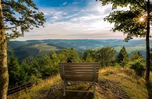
Soft waving mountains and valleys, deep forests, lush meadows and romantic craft villages in between - the landscape of the Sauerland can be described in a few words. It offers numerous opportunities for hikers, nordic walkers, prams and fresh air lovers.
A large number of certified quality hiking trails, especially the well-known Redhead's trail, make the Sauerland one of the most popular hiking regions in Germany - here you will experience the most beautiful hiking holidays!
Hikers in Upland and the nature park Diemelsee can look forward to hiking trails "bij uitstek" Around Willingen there is a network of quality hiking trails like no other in Germany. Willingen de nr. 1 for hikers in the Sauerland. The popularity of Willingen among hikers is mainly due to the huge traffic-free hiking area of almost 100 km2 on the ridge of the Rothaar Mountains between Willingen and Niedersfeld on ca. 700-843m with Germany's largest high heath, where most hiking trails lead. In this area there are also 10 of the 14 Sauerland peaks >800m, including the Langenberg - with 843m the highest mountain of the Sauerland.
Here you can also create your own personal walking route: TOURPORTAL SAUERLAND
Sauerland Walking Villages
Sauerland wandeldorpen Brilon, Diemelsee, Medebach, Lennestadt, Kirchhundem, Olsberg, Schmallenberg, Eslohe, Willingen, Winterberg en Hallenberg.
Middle de eerste gecertificierde kwaliteitsregio "Wanderbares Deutschland" (during Duitsland) is a close network of beautiful and well signposted hiking trails in the beautiful nature where you can discover and enjoy the original typical Sauerlands villages and their surroundings.
More information and the tour portal can be found HERE

Sauerland - altitude flight
The Sauerland-Höhenflug runs from Altena or Meinerzhagen to Korbach in Hesse, through the Sauerland hiking area and largely along the Sauerland Höhenkamm (mountain comb), part of which is derived from the name Höhenflug. Description: The 250 km long walk can also be experienced in parts - even for shorter walks. Nature lovers can look forward to fascinating natural experiences in deep forests, high bogs on the slopes of the Ebbe Mountains or the vast meadows of the Upland, the Hochheide, the Kahler Asten or in the beautiful European bird reserve Medebacher Bucht. The hiking trail Sauerland-Höhenflug offers much more than fascinating landscapes and beautiful natural idylles. Today, in the villages on the Sauerland-Höhenflug, cultural and industrial history, as well as traditional agricultural activity, live in the villages of the Sauerland-Höhenflug. Museums invite you to visit the history, industry and crafts of the region and get to know it. An essential feature of the Sauerland Höhenflug are the many incomparable views; the heights around Altena, the Hunau or the Kahler Pön near Düdinghausen, the Schombergturm on the Wilde Wiese, Kahler Asten or the lookout tower Georg Viktor near Korbach, the hiker gets a beautiful panoramic view everywhere! If you let your eyes and senses wander over mountains & valleys, idyllic villages, forests, meadows, streams, rivers and lakes - you will realize: Flying alone is better! Route: Altena - Neuenrade - Altenaffeln - Wildewiese - Wenholthausen - Bad Fredeburg - Altastenberg - Hallenberg - Medelon - Küstenlberg - Düdinghausen - Korbach www.sauerland-hoehenflug.deshows more
Rothaarsteig - the path of the senses
With its special proximity to nature, the gently curved lines, the clear water and the wealth of views, the 154 km long Rothaarsteig the number 1 walking route of Germany No more hiking trail attracts visitors every year. It runs from Brilon via Winterberg, Bad Berleburg to Dillenburg. The dimensions of the new hiking route offer more than pure nature. Along the Rothaarsteig there are numerous Experience stations and courses about forest and water, but you will also find art and adventure. Particularly popular are the approximately 40 meter long suspension bridge over a valley that is cut out at Kühhude and the 17,5 km long part like the "ForestSculpture path" (Forest Image Path) between Bad Berleburg and Schmallenberg. Another feature is the continuous design line and thus the special look of the original Rothaarsteig forest furniture such as benches, woodchairs, forest benches, forest swims, shelters and the Vesper islands. Description: This famous hiking trail runs north-south over the ridge of the Rothaar Mountains. It starts in Brilon, runs over the highest mountain of North Rhine-Westphalia - the Langenberg (843m) - to the Hochheide and Ruhquelle, then to Winterberg to the Kahlen Asten (842m). In the upper part of the Lenne, the Rothaarsteig veers west, crosses the Waldskulpturenweg near Schmallenberg and focuses on the Rhein-Weser-tower as the next phase. From there it goes south through the Rothaarvorhöhen to the Hilchenbacher Shop and further to the upper part of Lahn, Sieg and Eder above Netphen. Via the Haincher Höhe, the Rothaarsteig finally goes to its destination Dillenburg. In the region of Willingen, a particularly beautiful part of the Rothaarsteig of Brilon leads over the Bruchhausen stones and the Langenberg (highest mountain in the Sauerland and North Rhine-Westphalia) through the high heath Neuer Hagen and along the viewing point Clemensberg. The Rothaarsteig shares this part with the Uplandsteig. www.rothaarsteig.deshows more
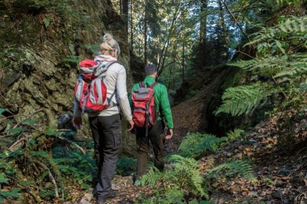
Kahler Asten-Steig - dream hiking in the Sauerland
A treat for hikers!
Whoever did it usually says that the Kahle Asten-Steig the most beautiful day walk of the Sauerland is. It is certified by the German hiking association as a premium hiking trail - and also as dream tour 2017.
Start and end of de 16 kilometer lange middelzware rondwandelroute is the park in Westfeld, one of the nine federal gold villages in Schmallenberger Sauerland. First, a narrow path goes uphill to the barbecue area and then continues over the valley hiking trail to Ohlenbach. Now the climb leads to the valley of the Schwarzen-Siepen, a nature reserve with the new climb bridge that spans a small biotope. Then the light goes uphill through a Kyrill area and a stalking path to the hunting huts.
An old canyon leads us straight up the mountain through a small gorge, along a small quarry, to the height of the walk, the Asten plateau with high heaths and a fantastic view over the land of 1000 mountains. Astenhaus is the ideal place to take a break before going downhill again along the Lenne source to young Lennetal.
Halfway the trail branches behind the ponds towards "Hoher Knochen." It passes through high spruce and beech forests to the top of the bone. Once upstairs we have another beautiful view over the vastness of the Schmallenberger Sauerland. From here it goes over a narrow path and a forest path downhill to the hotel "Hoher Knochen" with St. Elisbeth Kapel and Kneipp-bassin continue back towards Westfeld, where you can find a narrow root path along the cross-country skiing centre back to Westfelderpark, where you can enjoy your hiking day.
The Astensteig is a demanding hiking trail and requires a lot of endurance with its 570 altimeters. The lowest point is 493m, the highest point is 841m. Pure walking time approx. 5-6 hours.
Hiking map with height profile to download as pdf
shows more
Ehmsenweg - from Arnsberg to Olpe
The Ehmsenweg runs from the Ruhr valley to the Biggesee reservoirThe name of the hiking route is dedicated to the forest advisor Ernst Ehmsen (1833-93), who founded the Sauerland Mountain Association. Description: The walk starts at the old market in Arnsberg. Now it passes the Probsteikirche in the forest above Ruhrschleife, where the Sauerland Mountain Association founded a monument in honor of the founder in 1897. Here you have a great view over Arnsberg. Then you go through the Arnsberg city forest, into the Sundern forests to the old Capuchin monastery Brunnen, then into the Frettertal and along the Saalhausen mountains to the Karl May festival location Elspe. Behind Elspe the walk leads to the Lenne, the longest river of the Sauerland. After crossing the trail you go to the lookout tower Hohe Bracht (588m). Now it goes south until just before the Rahrbacher Höhe and at the end of the Ehmsenweg it veers west and ends at Biggesee in Olpe. Info Ehmsenpadshows more
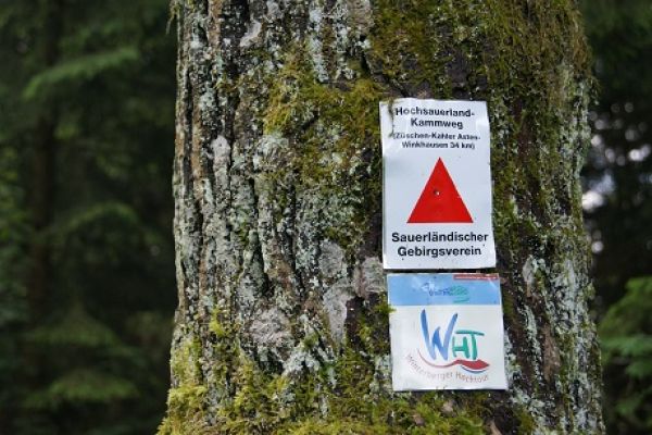
Hochsauerland-Kammweg - van Züschen naar Winkhausen
At only 34 km is the Kammweg a beautiful hiking trail for a weekend trip. It is once richly forested over the high ridge of the Sauerland along the Kahler Asten with Lennequelle and Hochheide. Description: From Züschen you first go up through the Züschenbos to the Ziegenhelle (816m), where the Kammweg meets the Sauerland Höhenflug. The intense climb is rewarded with a beautiful view. Now it goes through the woods on the Rothaarkamm along Mollseifen, behind which the climb to the "king of the Sauerlands mountains," the Kale Taks (Kahler Asten), begins - the highlight of the tour with a beautiful view of the Astenturm. Over the heath of the Kahler Asten and the Lenne source it now goes with a beautiful view to Altastenberg. Now it goes north to the Großer Bildchen, a pass at 708m - and then west to the Rolandshütte. Finally, the Kammweg runs as a long forest walk gradually downhill via Waldemei (724m), Schellhorn (660m) and Weißes Kreuz (500m) until it ends in the Winkhausen district (part of Schmallenberg). Info Hochsauerland-KammwegShow more
Kneipp-Wandelpad Olsberg
The name of the certified walking route already indicates a special topic: Here the hiker meets the teachings of Pastor Kneipp, and can reconcile his water therapy with hiking through natural water staircases along the hiking trail. Walking, water, feeling good What's more natural than the recognized Kneipp turret Olsberg writes such a theme trail on the flag. This 39 km long quality hiking route around Olsberg is also very suitable for a long weekend. On the way you can cool down hot soles in the six stairs and stray your thoughts. The Kneipp therapy is based on 5 health pillars: water application, exercise, relaxation, nutrition and medicinal herbs. The criteria for water use and movement are met by the Kneipp hiking route, which will start your health. Of course, the right Kneipp therapy also includes a stork walk and armgips. If you want to do well, you also have a watering machine and drinking cup in your backpack. So packaged, it is now to the idyllic water stairs in the forest. Route description: From the spa park it is well signposted and marked via the district of Gierskopp to the first step, at the Scharfsbrücke Gierskopp. The next step at Papendiek can be reached after a steep climb behind the Red Bridge. Now it goes to Eisenberg, where information signs on the Maxstollen explain the mining history of Olsberg. Now it is the highest mountain in NRW, the Langenberg (843m). Here the Kneipp-path meets the Rothaarsteig, Uplandsteig, the Winterberg high tour and the forest route. Now it goes downhill to Schellenstein Castle and the Gevelinghausen district with another castle and an old mill worth seeing. can visit. Now it goes along the Elpe for a refreshment to the Elpe-Tretstelle, then via Wiggeringhausen to the Ohlenkopf. After a long trip you reach the point of departure on the Vossbach, from where the Kneipppad gradually hits Olsberg again to the next point of departure along the Ruhr river to the Hasleyhut. A final climb leads over the cliff path to the top of the Olsberg with a beautiful view. The last step is the descent back to the center of Olsberg, where a last Kneipp stair bath refreshes the feet and the body. Info Kneipp walk path OlsbergShow more

Briloner Kammweg
The Briloner Kammweg leads 49 km around the Hoppecketal from Brilon to Willingen and back. It is a quality hiking trail that has been certified several times.
The mountains south of Brilon speak to the imagination. When walking over the narrow crest of rocks Broom heads, where gnarly trees crack from a moan, high grass leans in the wind, wild lupins and thimbles show an unreal, beautiful coloring game, one also likes to believe in the mystical and supernatural. The beginning of both the Briloner Kammweg and the Rothaarsteig is it Market Square of the city of Brilon with its beautiful semi-finished houses in Westphalian slate style, which forms the framework for the first kilometres outside the city.
Afterwards, it goes through the Spa Park and to the Möhne spring. You can experience the deep spruce and beech forests, as well as fantastic views of the vastness of the Sauerland, such as on the Borberg with its early medieval ring wall, the ruins of the former church and the chapel on the edge of the rock plateau.
The Borberg chapel offers a beautiful view down into the valley of the Ruhr river and on Olsberg. A detour leads to the Bruchhausen Stones, four huge porphyry rocks, on the highest - the Feldstein - a 40 m long via ferrata with breathtaking views. Other highlights of the tour are the "Ginsterköpf" and the Hohe Eimberg.
Tip: The official path leads along the Bruchhausen stones and only reaches the Stone Information Centre with a cash register below, where access for the stones is to be paid. If you want to join the rocks come, you can take a shortcut through the forest over Istenberg and Hörnberg and return shortly before the execution place on the original Kammweg. However, this route is nowhere on the official hiking trails - see route HERE.
The Kammweg is walked in 2-3 stages. If you are in good condition, the nicer half can walk over Borberg and Bruchhäuser Steine as a day trip to Willingen and take the train back.
Show more
Walk from the Kurpark-Brilon to the Borberg
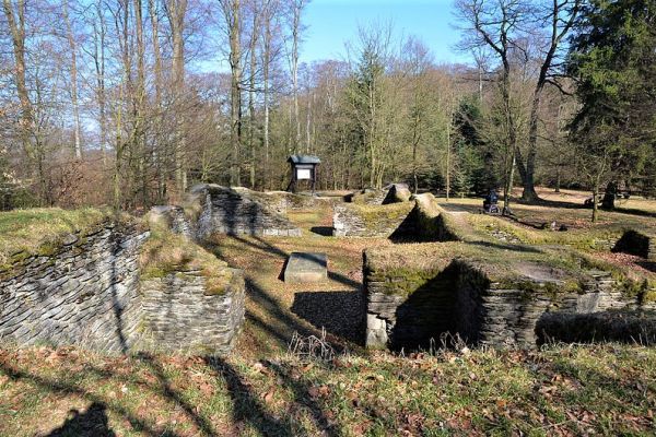
A beautiful walk in Brilon leads along the natural jewels of Brilon; It is partly about the Redhead's trail and Briloner Kammweg. The 13.5 km long tour starts and ends in the Spa Park. If that's too long for you, choose the 9 km short version of Kyrilltor in the district of Petersborn; that saves about 4.5 km. In the spa park we follow it landscape therapy path (direction doesn't matter) 100m to the Möhne sourceOn the way back we choose the other way, so that we have followed the landscape therapy route completely. From the Möhne source you continue to the Cyrillic Gate in Petersborn. It is a huge gate, piled up of tree trunks, to the hiking and cross-country paradise on the Petersborn plateau. From here the path 2.2 km leads across the village of Petersborn and beyond. After a climb at the end of the village behind Petersborn, the forest path is quite flat. You have to turn right once and then again left about 700 meters later. Then you are on the destination path to the Borberg chapel at approx. 602 meters above sea level. From here you have a beautiful views of Olsberg and Ruhr Valley. Cemetery of Borberg The Borberg terraces with their ramparts, ditches and hills attract the attention of the visitor. The oldest earth ramparts date from the time of the birth of Christ, when Germanic tribes encountered the Celts. In the time of Charlemagne (8th / 9th century), the fortifications were renewed into a walled castle. Remains of the north gate were exposed. In the 13th century there was a monastery church built, of which only the foundations walls are still standing. There are also remains of an early medieval cemetery discovered. After the archaeological visit it goes slightly downhill on the other side to the Kyrylltor. On the way you pass the rustic Mountain hut (opening hours click HERE) It is considered to be: one of the most beautiful huts in the Sauerland. A small stream splashes through the beer garden, where several walkways lead over it. The range of dishes is rustic and spartan, as is typical for a cabin. Now it goes on the same route as back to the Möhne source and then the other part of the therapeutic landscape path down to the spa parks, where a wonderful day of hiking ends. Route on Google Maps HERE Spa park BrilonAt Schönschede (Parking) 59929 Brilon Cyrillic Gate
Parking at the sports field 59929 Brilon-Petersborn
Show more
Medebacher Bergweg
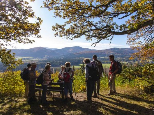
The 66 km long quality hiking route "Medebacher Bergweg" connects the city of Medebach with its beautiful craft districts. Description: The Medebacherbaai is also called the "Tuscany of the Sauerland." This region is called "Bay" because there is a prehistoric sea, whose fossils can be seen in many places - especially near Düdinghausen and Tetmaringshausen. Small paths through dense forests meander to the crossroads and chapels decorated at mountain heights, passing idyllic streams to the craft villages around Medebach. Sightseeing: The barite museum in Dreislar, which guides the senses through 4.6 billion years of geological history, is definitely worth a visit. Sounds, images, colours and light immerse the visitor in the underworld of sparkling crystals. Probably the most strenuous stage leads from Meledon to Küstelberg, because here you can overcome almost 400 meters of altitude - and the steepest slope to the 781 meters high Rösberg summit is rewarded with a fantastic view of the Winterberg plateau. The signs on the route about the history of the former Medebach-small railways and their double hairpin bends are also interesting - unique in the history of the railway. Info Medebacher BergwegShow more
Sauerland Forest Route
The 240 km long long distance hiking route "Sauerland-Waldroute" is magic & mysticism. This route from Iserlohn via Warstein to Marsberg and in a loop via Willingen and Olsberg back to Warstein. Here you will experience all nature, flora and fauna, heathlands, primeval forests and natural spectacles that the Sauerland has to offer. Ports to the Sauerlandse bosroute At all starting points of the 15 participating municipalities, there is at least one access gate to the forest route. There are paved areas framed by a hedge beech, where there is a gate, a modern seating area and an information board. We give away a description of the hiking trail, because it cannot be part of a holiday in an apartment. In each municipality you can walk through interesting pieces, about which the local tourist information provides. Route: Iserlohn - Hemer - Balve - Sundern - Arnsberg - Möhnesee - Hirschberg - Warstein - Kallenhardt - Rüthen - Büren - Alme - Marsberg - Diemelsee - Brilon - Olsberg - Bestwig - Eversberg - Warstein
Show more
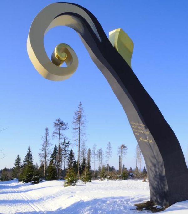
Forest sculpture trail on the Rothaarsteig
Nature meets art on the WaldSculpture Way!
This theme walk is a landmark and undoubtedly a hiking point in the Sauerland.
Description: What happens when internationally known artists interpret the eventful history between Wittgenstein, who was influenced by Protestants, and Sauerland, who is rooted in Cologne and Catholics? Simply put: eleven incomparable sculptures and productions on the WaldSkulpturenWeg, which polarize and stimulate the discussion. With their works of art, internationally renowned artists have created an art trail that is unique in Germany. It is 23 km long and runs along the Rothaarsteig access routes of the cities of Bad Berleburg and Schmallenberg, making the access routes a popular hiking trail in itself. www.waldsculpturenweg.deShow more
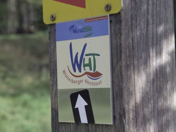
Winterberger Hochtour
The Winterberger Hochtour is with the Uplandsteig in Willingen the most popular hiking trail for holidaymakers in holiday homes in the Sauerland. Book a holiday apartment in one of the two most popular holiday destinations in the Sauerland and walk the individual day stages. Winterberger Hochtour is a certified quality hiking route. It starts and ends on the Kahler Asten and connects the districts Winterberg with each other. The Winterberger-Hochtour leads over the highest mountains of the Westphalian part of the Hochsauerland, crosses eight valley areas and offers numerous attractions from nature and culture. 10 stages. Route information Winterberger Hochtour Detailed information is available from the Winterberg tourist information and the Sauerland tourist information Addresses and website link HEREShow more
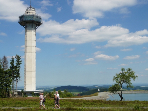
Hiking in Willingen & Nature Park Diemelsee
Hiking trails "premier"! The region around Willingen is probably the most popular hiking area in the Sauerland.
At the highest heights of the Sauerland in Willinger Upland, a network of certified quality hiking trails is spun like no other in Germany: Rothaarsteig, Uplandsteig, Diemelsteig, Kneipp-walking trail Olsberg, forest path, Briloner Kammweg, Sauerland Höhenflug, Medebacher Bergweg, Winterberger Hochtour.
The reason for this is the largest high heath in Germany on Ettelsberg and Neuer Hagen. The most popular hiking route in the Sauerland after the Rothaarsteig is the Uplandsteig - and the Diemelsteig runs like a mountain tour around the Diemelsee.
All the following hiking trails lead through the nature park Diemelsee
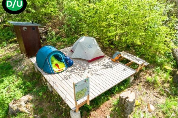
TrekkingPark Sauerland - spend the night outdoors in nature!
Trekking - i.e. doing without permanent accommodation instead of sleeping in an outdoor tent - becomes increasingly attractive as a hiking experience.nature park Diemelsee are since 2021 nine trekking platforms available for multi-day walks, which can be booked online. Dogs are welcome. The trekking park was already in the first season a hit and was fully booked. All trekking platforms are located in beautiful nature and are only accessible on foot via the quality hiking trails Diemelsteig and Upland SteigYou're on your own, including food and equipment, what a real trekking feeling All platforms have eyes for fixing the tents and a compost toilet. Each campsite offers great views and natural experiences. From beech and spruce forests to semi-open forest areas, to views of vast moors, springs, extensive meadows and fields, wild pots, sunrises/sets, starry skies... and more. The trekking spots are only bookable in the warm half of the year from 1 April to 15 November so that the local species have sufficient rest and retreat in the winter months. "Wild" use of the trekking places outside this season is not allowed. Free public transport: In all cases the bus and the so-called Collective Beltaxi (AST) are free with the MijnCardMobil, which is included in the booking. We also recommend the corresponding Willingen & Diemelsee hiking map on scale 1: 25,000 to, on which all the trekking spots are marked. More information and reservation on www.trekkingpark.deshows more
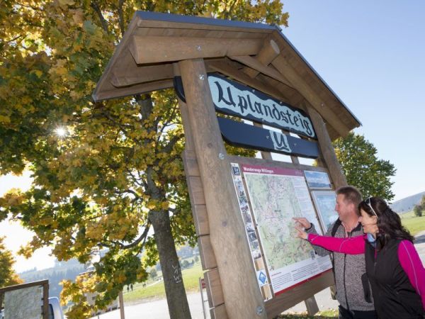
Uplandsteig - a walking dream
Measured by the number of Internet visits, the Uplandsteig after the Rothaarsteig is the second most popular hiking trail in the Sauerland.
The Uplandsteig, a demanding walking trail of 64 km long, once leads around and through the municipality of Willingen (Upland). Its description of the Uplandsteig is divided into 5 km sections. The landscape's appearance changes time and time again, from mixed forest, beech forest, fields, flowering meadows, marshy landscapes and high heathlands. From the highest peaks of the Sauerland, the hiker awaits countless beautiful views.
Sometimes the Uplandsteig divides its path with the Rothaarsteig, the Sauerland Höhenflug, Diemelsteig and the Briloner Kammweg.
For more information: Upland Steig
Show more
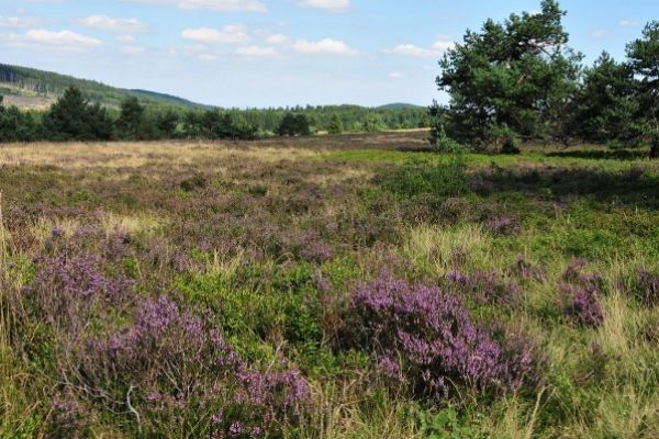
Hochheide Rondenwalkweg Ettelsberg - Neuer Hagen
One of the most popular Sauerland hikes leads from Willingen over the Ettelsberg to Germany's largest high heath Neuer Hagen (Niedersfelder Hochheide) and the Langenberg (at 843m the highest mountain of the Sauerland) and through the Hoppecketal back to Willingen. It is a circular route.
The route recommended by us starts at the valley station of the Ettelsberg cable carThe cable car takes you to the 838 meter high Ettelsberg with its Hochheide Tower - the highest viewing point in North-West Germany at 875 meters - and Siggi's famous Ettelsberg hut.
Then it goes by the Kyrillpad to New Hagen, Germany, the highlight of the tour. From the 838m high viewpoint on Clemensberg you have a beautiful view over the Winterberg plateau. At the end of the Hochheide awaits the Niedersfelder Hochheide-hut, where you can strengthen about halfway. Then it goes to Langenberg (at 843m the highest mountain of the Sauerland) and from there downhill into and back to Willingen.
The trip is about 13 km and takes about 3 hours walking. However, you have to wait 6 hours with breaks, refreshments, views and enjoyment. The route mainly runs on forest roads, but sturdy shoes are recommended.
Show more

Milk adventure trail Usseln
Nature experience for the whole family - The Milk Experience Path Usseln is a family hiking trail with 10 exciting, active adventure stations that are all about milk. It is part of the MilchMUHseum of the Upland dairy farm for organic milk.
The 6.4 km long tour starts at the tourist office in Usseln. For children there is one quizsheet (download here), that can be filled in and surrendered at the end of the path in the dairy farm Upland for children up to 14 years old has a refreshing price. Alternatively, the quiz sheet is also available from the tourist office of Usseln.
The trail with 10 adventure stations leads along the young Diemel along the former Usseln ski slopes to the duck pond with playground. The first interactive station is located at the Pön hut near the Usseln ski lift. It continues to the Diemel source with the cow sound and then to the Graf-Stollberg-Hut, where there is a hay barn cinema. Then it's about a panorama path to the Hochheide Kahle-Pön, where you can pick blue berries in the summer - and then go down towards the MilchMUHsuseum in Usseln. On the way you can wait even more adventure stations.
The milking experience route is suitable for all-terrain prams and in combination with the MilchMUHseum a fun adventure excursion for the family. Duration with children approx. 3.5 hours. On the way there are two places to stop at the Pön hut and the Graf Stolberg hut.
Route on Google Maps HERE For more information: www.milchpfad-usseln. deShow more

Upländer pilgrimage route - "Space of life" path of reflection
"The route is the goal" If the world-famous Jacobsweg is too long and too far away for you or for whom it does not fit into your holiday planning at the moment, there is an interesting alternative in small format.Upländer PilgerwegYou can find an inner contemplative rest for a weekend and recharge your batteries for mind and soul. Follow the traces of your life! The easy-to-walk trail of 17 km length is divided into four sections with a total of 46 reflection stations and offers not only beautiful hiking trails and impressive views, but you also want to live in peace and contemplation over your life. The Upland pilgrimage route is a kind of "trim-jezelf-pad" for the soul. The well-marked route does not require a hiking map. During your pilgrimage you will be accompanied by station signs with contemplative topics and suggestions. The "pelgrimskerk" in Schwalefeld and the "lichtkerk" in Rattlar are highlights on the pilgrimage route. Upland reflection
Show more
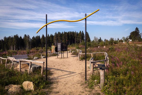
"The Golden Path" - themed walk Hochheide Neuer Hagen
If you do not want to walk the big round of 15 km from Ettelsberg to Neuer Hagen, this small tour is perfect to experience the beauty of Germany's largest high heath. theme trail "Golden Path" 'Doctor Nature' is working on the 10 mindfulness stations of the Golden Path . Once you have walked, experienced and internalized the 10 stations of the Golden Path, this circular trail leads about 5 kilometers over the Niedersfelder Hochheide, which towers above the Sauerlands mountains at the foot of the highest Sauerlandse summit - the 843 meter high Langenberg. The encounter with nature often feels like a journey to yourself! On the landscape therapy path through the fascinating Niedersfelder Hochheide the following 10 mindfulness stations await you: Extensive space; Heather carpet; Mother Nature concert; the cross; bizarre pines; the observation trip; Meditation site; Hoppecke source; Natural flavors and wind harp The Hochheide Neuer Hagen / Niedersfelder Hochheide (parking lot near Niederfelderhütte) can be reached by car from the B480 Olsberg-Winterberg and is signposted in the center of Winterberg-Niedersfeld. More information about the Hochheide HEREshows more

Diesteig - natural walking...
The Diemelsteig is a certified and demanding quality hiking trail of 63 kilometers through large parts of the nature park Diemelsee.
It leads along the lake, through deciduous forests, over mountain combs and to viewpoints and towers. Sauerland mountain hiking park and the Sauerland Forest Route.
The Diemelsteig starts at the "Haus des Gastes" in Diemelsee-Heringhausen. From there it goes via Rhenegge to Adorf, further to Wirmighausen, Flechtdorf, Deisfeld and Schweinsbühl. In Hemmighausen the Diemelsteig runs together with the Uplandsteig to Ottlar and then 'alleen' back to Heringhausen.
The Diemelsteig is 63 kilometers too long to be tackled in a day route. So treat yourself to a multiday stay in a beautiful holiday apartment or holiday home in the Diemelsee. Other fun activities on the Diemelsee and in Willingen complete your hiking holiday.
For more information: Diemelsteig
Show more
Webcams from hiking viewpoints
Webcam: Winterberg - View of the Kale branches
View another image ↗

Webcam: Kale branches - View of the tower
View another image ↗
Webcam: Schmallenberg County
View another image ↗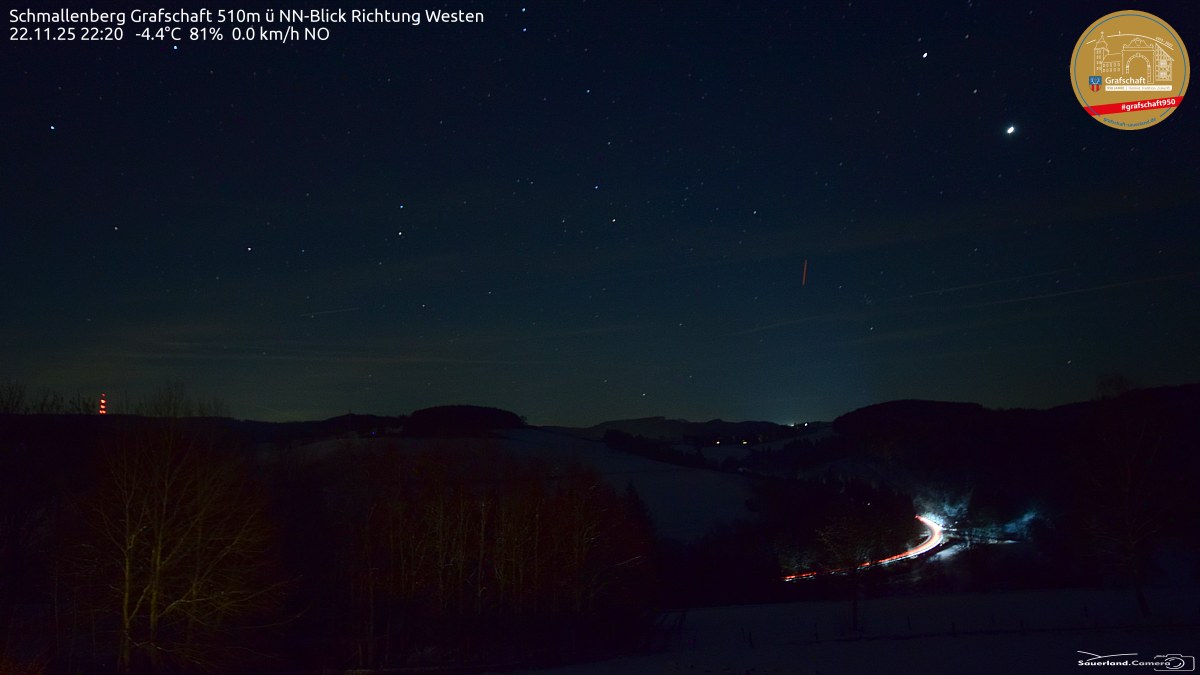
Panorama on the Hochheide Tower Willingen - 875m
View another image ↗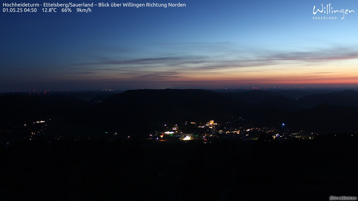
Webcam: Usseln . . Graf Stollberg-Hut
View another image ↗
Webcam: Panoramic mountain Hohe-Bracht - Homerblick
View another image ↗
You may also be interested in!
Holiday homes Willingen / Sauerland
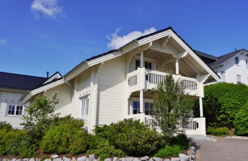
Willingen & Diemelsee ----- all Information -----
All Sauerland info - holiday & excourses
Sauerland-Card for the entire Sauerland

Forest sculpture trail on the Rothaarsteig
Open on the original website ↗
Rothaarsteig - Path of the senses
Open on the original website ↗
Walk to the Hochheide
Open on the original website ↗
Walk around the Diemelsee
Open on the original website ↗
Walk around Willingen
Open on the original website ↗
On the road in the hiking villages of Sauerland
Open on the original website ↗
800 hm walk in the Rothaar Mountains
Open on the original website ↗
Sense path at the Hennesee
Open on the original website ↗
Kahler Asten-Steig (16 km topwandelpad!)
Open on the original website ↗
